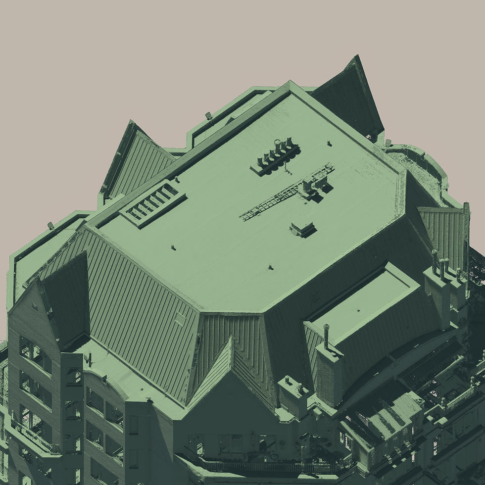
Maritime Condominiums
Client / Collaborator
COEX Architecture
Sector
Architecture, Résidentiel
Location
Laval
Services
Relevé LiDAR, Relevé par drone, Photogrammetrie, Modélisation Revit
Mandate
As part of this residential project, DGTL was commissioned to create a detailed 3D scan of the building, create a Revit digital twin, and produce a textured mesh hosted on an online platform. In this context, COEX entrusted us with the 3D scanning of the building’s exterior and its surroundings to produce an accurate reference dataset for the architectural team.
The goal is to accurately document the existing condition of the roof and building envelope, so that consultants can identify any potential issues that are invisible to the naked eye.

Mandate
As part of this residential project, DGTL was commissioned to create a detailed 3D scan of the building, create a Revit digital twin, and produce a textured mesh hosted on an online platform. In this context, COEX entrusted us with the 3D scanning of the building’s exterior and its surroundings to produce an accurate reference dataset for the architectural team.
The goal is to accurately document the existing condition of the roof and building envelope, so that consultants can identify any potential issues that are invisible to the naked eye.
Proposition
GNSS Georeferencing and Control Network
A control network is implemented to create a robust geometric reference at the site-wide scale. The control points are georeferenced using a high-precision GNSS system, ensuring data positioning.
The control points are distributed along the exterior walls and ensure spatial consistency, the integration of the various acquisition campaigns, and the reliability of the data used for 3D scanning and the production of the 3D model.
Mobile LiDAR (SLAM) outdoors
A SLAM-based LiDAR survey is conducted on the ground floor and in the surrounding area, to obtain a comprehensive and detailed representation of the existing conditions. The SLAM data is then registered and adjusted using the control network to ensure a consistent, usable dataset tailored to the architects’ needs. This method enables a quick and efficient survey.
Drone Survey
A photogrammetric survey is carried out using a drone equipped with a high-resolution camera to document the upper parts of the building, including the roof, which are hard to access from the ground.
The 7,000 images acquired are then linked to the primary control network. These images help create the point cloud and the detailed mesh that accurately represents the observed surfaces.
Coloured Point Cloud
The overlapping areas between mobile LiDAR data and drone-based photogrammetric data are strategically segmented to ensure a seamless transition between the two different technologies. This approach results in a unified, consistent, and continuous dataset, while ensuring optimal coverage of the entire building.
Deliverables
Coloured Point Cloud
Delivery of a colour point cloud generated from mobile LiDAR and photogrammetric data. Aligned with the control network, it provides an accurate and reliable measurement basis for analyses, inspections, and any future work.
Textured Mesh on an Online Platform
Based on the images captured by the drone, a 3D mesh is generated. The textures extracted from the images are then projected onto the surfaces of the mesh to reproduce the appearance of the materials and to document the conditions of the exterior components, such as the masonry.
Revit Model LOD 200
A digital twin at LOD 200 is provided. The 3D model offers the architectural team a clear, structured, and directly usable digital representation.
LOD 200 allows for the representation of the building’s systems, volumes, and components, while supporting analysis, interdisciplinary coordination, and project progress.
The Revit model is completed/done using the client's Revit template to eliminate any wasted time associated with transfering their standards
Quality report
A 20-page quality report details all fieldwork and post-processing stages. It outlines the methodologies and technologies used throughout the project. The report also includes images taken during the survey, tables showing target positions, and comments on weather conditions.