
Residential house
Client / Collaborator
ARCHITEM
Sector
Architecture, Résidentiel
Location
Montreal
Services
Relevé LiDAR, Dessins CAD
Mandate
As part of this residential project, we were commissioned to produce a complete and accurate digital twin of an existing single-family home. The main objective was to accurately document the current state of the building and its grounds in order to generate detailed CAD sections and plans that could be used directly by the professionals involved in the project. Geometric accuracy was a key issue in ensuring consistency between the built reality and the technical documents produced.
Proposition
In order to guarantee a high level of accuracy and perfect consistency between the interior, exterior, and terrain, we implemented our usual hybrid methodology, structured around a primary control network.
GNSS georeferencing
We measure high-precision GNSS georeferenced reference points over several periods in order to establish a robust anchor to the project's coordinate system. This step ensures a stable reference for all acquisitions.
Primary control network
We set up a control grid using a total station to obtain a millimeter-level precise framework and a direct link between all technologies. This network serves as the "ground truth" for checking consistency and limiting drift.
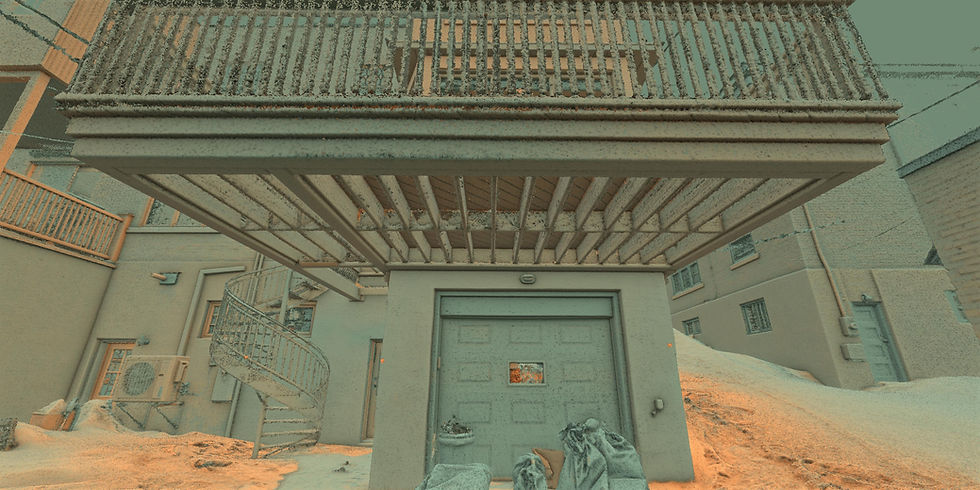
Mobile LiDAR (SLAM) indoors and outdoors
We perform SLAM mobile LiDAR scanning to efficiently capture the interior, circulation areas, as well as outdoor areas and terrain, while ensuring complete and continuous coverage. Trajectories and point clouds are linked to the control network to maintain overall accuracy.
Deliverables
High-density point cloud in colour
We deliver a dense and accurate point cloud covering the interior, exterior, and terrain. The point cloud is linked to the control network to ensure consistent geometry between all parts of the building.
Quality report
We provide a quality report that documents the chain of control and data validity, including georeferencing statistics, primary network residuals, and checkshots.


CAD plans
To facilitate the production of CAD drawings, we have generated scaled X-ray-type images. Each pixel in the images corresponds to 3 mm in reality. This greatly facilitates importing into AutoCAD or Revit, scaling, and producing drawings.
The view range of each drawing is different in order to display the necessary information.
The first image has a depth of 200 mm so that the thickness of the walls can be easily identified.
The second image has a depth of 1400 mm so that all components in the space are identifiable.
The third image shows a depth of 1,700 mm so that the structure supporting the floor can be positioned in relation to the floor plan..


