Prince Artur
Client / Collaborator
Marfoglia
Sector
Architecture
Location
Montreal
Services
Relevé LiDAR, Relevé par drone, Dessins CAD
Mandate
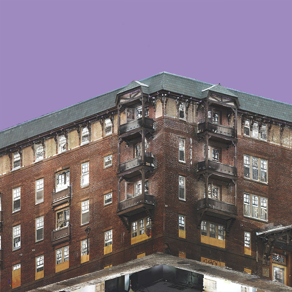
We were commissioned to carry out a complete digital scan of a building on Prince Arthur Street, including the exterior and all interior spaces on five levels. The objective was to produce a reliable geometric base for the creation of AutoCAD plans and elevations, with a level of precision compatible with design coordination and work preparation.

Mandate
We were commissioned to carry out a complete digital scan of a building on Prince Arthur Street, including the exterior and all interior spaces on five levels. The objective was to produce a reliable geometric base for the creation of AutoCAD plans and elevations, with a level of precision compatible with design coordination and work preparation.
Proposition
To ensure the overall accuracy of the digitization, we set up a primary network of control points measured using a total station, in order to limit errors to a few millimeters across the entire building. This network is linked to several georeferenced points measured using high-precision GNSS, over several periods, in the form of permanent points near the building.
Terrestrial LiDAR
Terrestrial LiDAR is used to scan the exterior envelope of the building at very high density in order to capture the geometry of the facades, openings, and architectural details. The stations are linked to the primary network, ensuring millimeter accuracy and a point cloud that can be used directly for elevations and accurate modeling.
Mobile LiDAR (SLAM)
Mobile SLAM LiDAR is deployed indoors to quickly and comprehensively capture traffic, rooms, and volumes across all five floors. Linking to the control grid limits the drift inherent in mobile systems and provides a consistent, accurate, and high-performance 3D survey, ideal for producing AutoCAD plans and speeding up coordination.
Drone photogrammetry
Drone photogrammetry is used to document roof conditions and hard-to-reach areas, with high-resolution images allowing for verification of technical elements, surveys, and details of the upper envelope. The data is georeferenced and integrated into the same reference system as LiDAR to deliver a complete dataset.
Deliverables
High-density color point clouds (interior and exterior)
We deliver a high-precision, color 3D point cloud covering the entire interior and exterior of the building, linked to the primary control network to ensure reliable geometric consistency for the production of plans, elevations, and technical coordination.
AutoCAD plans and elevations ready for design
We produce detailed AutoCAD drawings, including floor plans and exterior elevations, based directly on the 3D LiDAR survey and validated by the control framework. This documentation serves as a solid basis for design, intervention planning, and monitoring of existing conditions.
Quality report and accuracy statistics
We provide a comprehensive quality report that documents GNSS georeferencing, the creation of the total station control network, as well as statistics and residuals from the various technologies (terrestrial LiDAR, mobile SLAM LiDAR, and drone photogrammetry). This report demonstrates the accuracy achieved and justifies the metric reliability of all deliverables.